I have never come across a town plan of Barlick for 1800 so what follows is the result of evidence I have gleaned over the years. The connections to the roads out of the town were so different then it's hard to know where to start. First the ones that hadn't changed. Bracewell/Gisburn was the same course as today, Skipton only changed inside the town itself. Let's start with the most important, the Colne Road coming down into the town via Higher Lane and Colne Road.
The first thing to note is that there was a ford across Gillians Beck at the bottom of what is now known as Lamb Hill. It was culverted in the 1850s by which time Church Street had come into being. Before this the road followed an entirely different course. Once you crossed the ford you headed up what is now a ginnel behind the Squatter's House and crossed the bottom of Barnoldswick Lane, which was then a minor internal route, and went straight up the hill alongside Crossley House. This is now Philip Street but was then called Back Lane. This cut right through the town along the route it follows now and headed out down what is now Long Ing Lane.
The Skipton Road came up into the town and went up what is now Newtown joining Back Lane at the top. This is now blocked by Craven House and all that remains is a ginnel up the side into Back Lane. If you think about this layout and recognise the development that started when Butts Mill was built in 1843 these roads were seriously inadequate. They must have been choked with traffic even then. The local vestry, the forerunner of the modern town councils had to do something. Their first move was to sell the village green where Church Street is now, use the money to culvert Gillians Beck, divert the main Colne Road into a new road, now Church Street. Newtown became redundant as a through route. It may be that at this time Barnoldswick Lane became a main route and changed its name to Manchester Road.
This made things easier in that it catered for through traffic coming in from Bracewell and Skipton but did nothing for local traffic coming in from Earby and Kelbrook. If you think about it, the only way was to come from Earby via Salterforth Road up through what is now the Ranch, across the ford and straight up Salterforth Lane to Higher Lane and from there down into Barlick. Think of the poor horses and that steep bank. In the days when Park Close Quarry was sending stone into Barlick they installed a steam winch on the triangle at the top to assist the stone wagons but I don't see how this helped Earby traffic coming to Barlick.
Apart from minor changes this was the local traffic pattern for almost the next hundred years and it became increasingly obvious that a radical solution was needed.
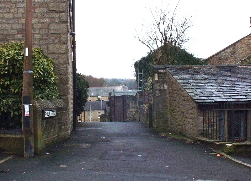
Philip Street. Hard to believe this was the main road at one time.