

I have an association with East and West Marton that goes back 65 years. During that time I have worked at the dairy and for various farmers in the district, mainly my happy years working for Richard Drinkall of Yew Tree Farm. During that time I have picked up an lot of local gossip and information and since then have learned much from my research. I thought it was about time I dragged it all together so brace yourselves, the next few weeks will be a Marton fest and will be a mixture of basic history and stories. One thing, historically East and West Marton were known collectively as Martons Both and to save space I’ll use that term when talking about the general area.
Let’s start over 10,000 years ago. It was at about this time that the climate started to warm after the last Ice Age and in the process of melting and receding the ice left evidence in what had been flat valleys, it deposited the rock and debris it had picked up during its travel down from the North and this formed a landscape dominated by many small round hills called Drumlins. Martons Both sits in the middle of a classic Drumlin field and is what the old farmers used to call ‘uneasy land’, if you aren’t going downhill you are going up! If you go up onto the slopes of the Weets and look to the North you’ll clearly see what I mean. Much of what was deposited is good river bottom silt and this is why the villages have always been recognised as good land for farming with the possible exception of some land like that at Marton Scar which is a natural rocky outcrop and has thinner soil. Incidentally, this was never a handicap because the farm produced some of the highest quality of milk taken in at the dairy. A tribute to good young stock and the fact it was close to the underlying limestone rock. This limestone is the same strata that gives Barlick good limestone quarries on the north side of the Craven fault which runs across the top of the town. This is why there used to be a large lime kiln at Stainton House and numerous small quarries in the same area. The drainage is into the Ribble Valley and there are no major watercourses in either of the Martons, but many good springs.
The Leeds and Liverpool Canal passes through East Marton and the land to the north of West Marton. The main road from the West Riding and further out, the North East coast, runs across to Preston and the Fylde coast and cuts right through both villages but is not as busy as it used to be in pre-motorway days.
There, we have set the scene, next week I’ll tell you what I know of the history of both villages. I promise you, there’s a lot to tell! I’m quite enjoying this, I hope you are as well!
SCG/05/05/19
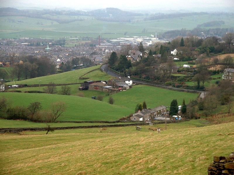
The drumlin field seen from Tubber Hill.