Although the Domesday Book Major was produced in 1086 it is fair to say that the information relating to land holding and land use reflects the earlier centuries when the Anglo-Saxons and Skandinavians settled the landscape. If a direct comparison were to be made between the occupied landscapes of 900AD and 1086AD then we would see that by and large it was only the names of the overlords and their sub-tenants that had changed.
In the decades prior to the Norman Conquest the overlord of our area was Gamal. It is very likely that Gamal, who was based within the Leeds area, gained his extensive landholdings in the North of England through his military support of the king. A list of his lands included areas extending from Burnley (the lost village of Gambleside was probably named after him) through Cravenshire. This may have been the Gamal and his son, Gamal Barn (barn = 'the younger') who appear as sub tenants within the Barnoldswick and Gisburn Domesday entries. However, the Normans had taken over the overlordship in 1086 and we see that Roger de Poitou had the twelve carucates of taxed land within Barnoldswick at this time.
By locating these twelve carucates of agricultural land we can gain a valuable insight into the original extent and layout of Barnoldswick within the later Anglo-Saxon period. The first problem is to fix the extent of the area known as a carucate - the problem being that medieval land measures were largely based on the area of land that an ox or a plough team could plough within a day, a season or a year. Add to this the fact that the size of an acre differed across regions and we are struggling a bit! However, having plotted early field systems and boundaries through the use of aerial LiDAR data and air imagery, then measuring the resultant cultivation patterns, there is good reason to take the carucate (within our district at least) as having covered an area of some 120 acres. It is possible, then, to create a workable model for the pre-Norman land settlement of Barnoldswick.
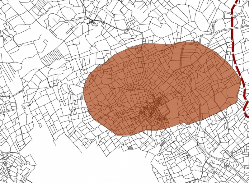
Original Barnoldswick field system core from LiDAR - the pattern we see today is a mixture of Iron Age and medieval fields overlaid by consequence of modern farming
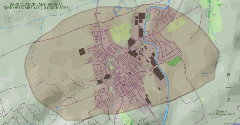
Basic plan of the 12 carucates of land taxed within Medieval Barnoldswick at the time of Domesday
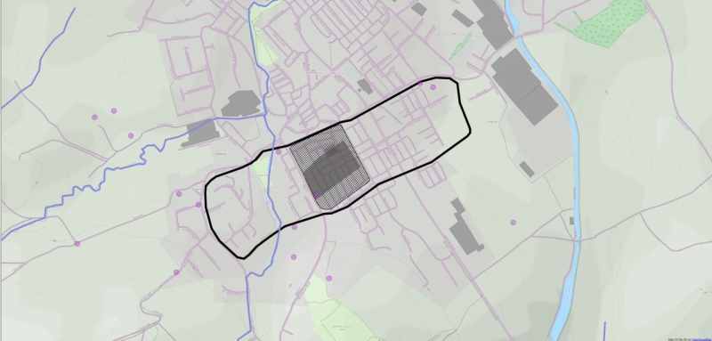
It is also possible to use LiDAR evidence to find linear patterns within built-up areas in order to find the original layout of a town or village. This is a fairly straightforward task in the case of Barnoldswick as the core of the early village settlement can still be seen around the Wapping and Townhead districts. Location of the original field and tracks through LiDAR forms a base on which nineteenth century maps and air images can be overlaid - this allows for the stripping away of subsequential building development in order to form the original 'wire frame' of a settlement.
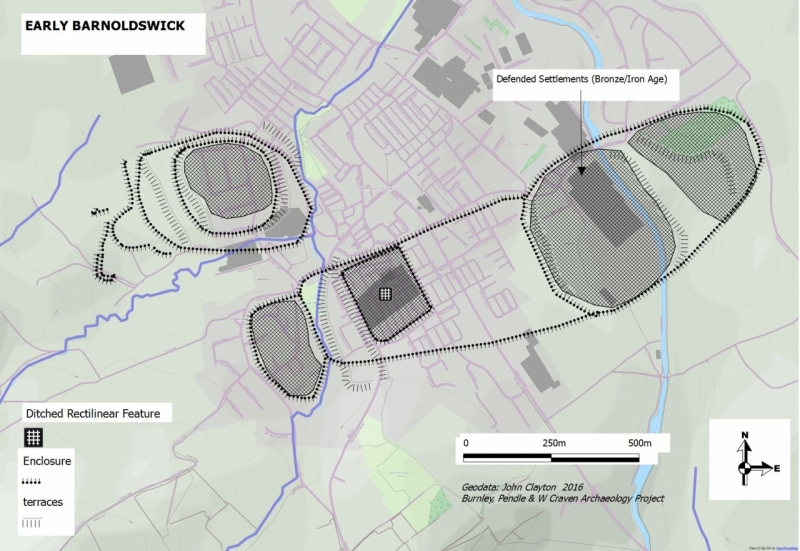
It is reasonably clear that Barnoldswick originally grew around an ancient ditched settlement (Bronze Age) that is still known to this day as The Hey. It is notable that the main prehistoric trackways have survived within the village, although some have changed course markedly over time. Barnoldswick was located at the crossroads of two arterial routes, one ran NS directly from the hillfort at Castercliffe (Colne) via Foulridge to the Barnoldswick village enclosure and on the ancient ford across the Ribble at Nappa. The other ran EW from a Bronze Age settlement at Middop (running parallel with the 'Roman' road through Brogden) to the Barnoldswick village enclosure, along Rainhall Road and up to join the 'Roman' road at Thornton.
It is interesting that Barnoldswick village did not develop alongside the Brogden to Elslack 'Roman' road. One reason for this is possibly that the land in between these two features (St. Mary's Mount area) appears (at this early stage in the survey) to have been a defensive site (minor hillfort) and subsequently a religious site and would not be readily settled.
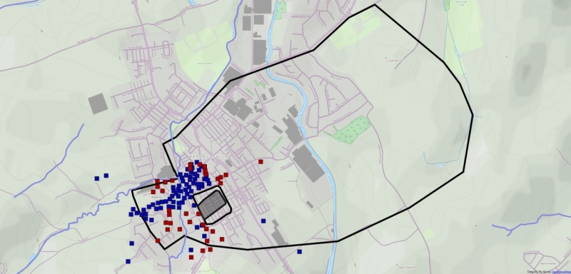
The image below illustrates the ground evidence for buildings around a central raised area (the original prehistoric ditched settlement) probably during the period of the 12th to 16th centuries. Within this pattern we can expect to find the original buildings from when Bernulf and his contemporaries settled here. A valuable exercise would be to walk the old town area and plot the old extant toft boundaries - this should allow for buildings to be put on the plans along with their associated burgage crofts.
Proposed burgage/toft/croft locations within Medieval Barnoldswick