Let's look at routes in Barlick in 1800. The roads out to Bracewell and Gisburn followed exactly the same course as today. The road out to Skipton changed at that time when the Leeds and Liverpool Canal was driven through the town. In most cases where the canal crossed a road it simply meant building a bridge as at Coates and Long Ing. If the canal divided a farm an access bridge had to be built, Banks and Eastwood bridges were good examples and a high level bridge had to be built over the access canal to Springs Quarry to cater for traffic from Salterforth to the church at Gill, all of them gone now as they became redundant. However, at Greenberfield Farm there was a bit of a problem.
The road from Coates to Gill Brow, Coates Lane, originally turned NW at what is now the junction with Whitworth Way and went down a steep hill to join Greenberfield Lane on the west side of the farm. You can still see the embankment and original road bed below the canal. As the canal was being constructed the company originally installed a timber swing bridge at this point. An access bridge was needed at Greenberfield and so, without consulting any of the local land owners the Canal Company drove a new section of road alongside the canal and combined the access bridge with a road bridge. Coates Lane now crossed the canal at this point and rejoined Greenberfield Lane to the East of the farm. There was a lengthy court case but in the end the company got their way and that is the route the road follows to this day.
The routes out of the town to the South and West were more complicated because of the difficult terrain. Let's take them one by one. The most important destination was Colne and the preferred route was via Wapping on to Colne Road (!) joining what was then the minor road Barnoldswick Lane at Bancrofts Farm and becoming Higher Lane which climbed steeply to the head of Salterforth Lane and from there followed the contour to the junction with the road from Barrowford to Foulridge. You turned left there, down Cocker Hill and joined the old Skipton to Colne road, Stone Trough Lane/Skipton Old Road since replaced by the 'new' road through Hague.
Access to Earby and Kelbrook was possible from Coates via Cross Lane but there were frequent disputes about that and it was very badly maintained. At one point the Manorial Court banned heavy wheeled traffic on it so the most usual route was to go up Colne Rad and Higher Lane then down Salterforth Lane, across Salter's Ford and on to Earby. This was a very ancient packhorse route and originally a Salter's Way.
Right, I think we have a picture now of how different the routes outside the town were. Next week I'll look at them inside the town. You may get one or two surprises!
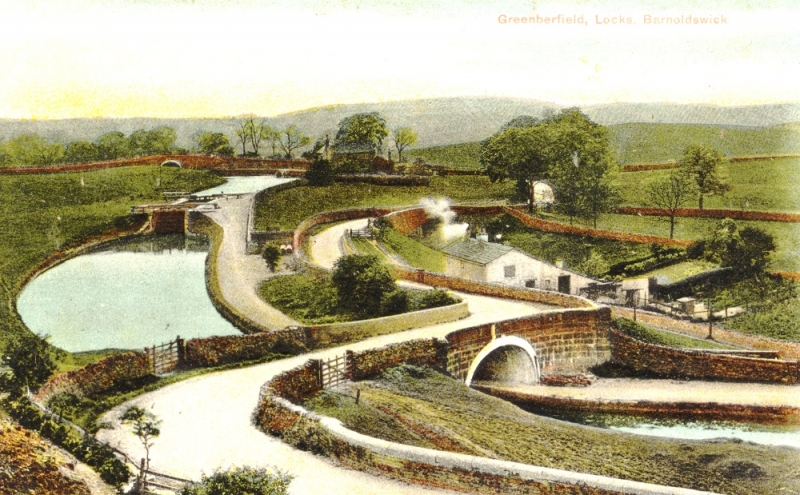
The 'new' road layout at Greenberfield Locks.