Med. Bick GE
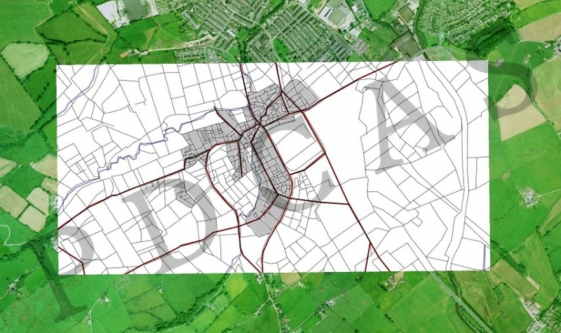
Plan of suggested Medieval burgage/toft/croft settlement areas and associated trackways in Barnoldswick. Overlaid on Google Earth image (copyright). Ext. from LiDAR and aerial imagery by John Clayton (Burnley, Pendle and West Craven Archaeology Project).

-
John C Layton
- Newbie
- Posts: 54
- Joined: 09 Dec 2015, 15:57