I start with a bit of a puzzle. The picture this week is a marker stone that stands on the North side of Cross Lane close to the village. I have to say that I need a bit of convincing that it is a genuine marker. Apart from the paint, I don't see any signs of weathering and from the script one would guess at an age of perhaps three hundred years. Further, I have never come across the name Musghyll Gate before. The meaning of gate is right, it was the word used for a way or road, think of Cross Gaits pub at Blacko and the spelling of 'layne' is contemporary. However, 'ghyll' causes me a bit of a problem, the common spelling of this in the 17th and 18th centuries is usually 'gill' but not exclusively so. I would have guessed at 'Musgil' as a spelling at that time, less carving apart from anything else. Sorry to start on a negative note but my mind is open and I'd love to be convinced.
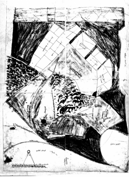
My information for Salterforth up to the latter part of the 18th century is sparse. 'Saltreford' is mentioned in Domesday (1086/87), 'Salterford' in the Close Rolls for 1241 and the same spelling again in the Kirkstall papers between 1216 and 1272 (Henry III). My local knowledge is limited to the names of some families I know were living there. However, even a negative report can tell us something. Let's go back to 1580. The earliest map I have ever found of the area is the 1580/81 map which was drawn up for use as evidence in a dispute between Tempest et al tenants of Barnoldswick versus Bannester et al tenants of Foulridge in the Duchy of Lancaster court (Tempest and Bannester were the respective Lords of the Manor. If you want to see the original go to the Record Office at Preston and ask for 3437. Barnoldswick. 1580/81. Page 507. (DL 31/106)) The map is crude but accurate and shows a lane leading down from High Lane down to the village called Salterford Layne. The village itself is roughly the same size as Barlick was at that date. I know that we are all certain that Salterforth is far older than these dates but if we are trying to nail the history down we must take notice of the firm evidence which shows quite clearly that for over a thousand years the village quietly went about its business farming the land, engaging in the cottage textile trade no doubt and catering for the travellers across what must have been, in those days, a busy cross roads.
One thing puzzles me in all this. Like Earby, Salterforth never had an early church and one wonders how far they had to walk to worship. Remember that Elizabeth I's Conformity Act passed in 1559 made church attendance theoretically compulsory until 1650 when the requirement was removed. The Earby parishioners had to walk to Thornton, one supposes that the Salterforth parishioners would go to Gill Church at Barlick which was nearer. One interesting result of this was that when the Leeds and Liverpool Canal Company started working Rainhall Rock quarry in about 1800 and cut through the footpath from Salterforth to Gill they had to erect a very substantial bridge over the quarry to preserve the right of way. One other thing puzzles me, we have seen from the report in the Craven Herald of 1930 that Salterforth Parish Council existed as the official local government, how do you have a Parish Council without a parish? The only thing I can suppose is that by that time the name was more administrative than ecclesiastical. (And yes, you're right, there is an awful lot I don't know!) The lack of a church may explain why a Quaker Meeting House was established in the village in 1726 and survived until 1989.
By the end of the 18th century we start to find firmer ground. The Bracewells at Coates and others in Barlick had erected water powered textile mills and were producing roving for the cottage spinners. It's worth mentioning that there is no evidence to suggest that they used the Arkwright frame for making yarn. The cottage textile industry was very important and almost every farm and cottage in Salterforth would be either spinning yarn or weaving cloth. At first this would be predominantly wool but by the early 19th century cotton had almost supplanted the old trade based mainly on the merchants at the Cloth Hall in Colne. This trade expanded due to increased demand in the mid 16th century and many historians attribute the rise in population that started then to higher levels of earnings from the wool trade. This also explains part of the reason behind the 1580 dispute between Barlick and Foulridge and the early enclosures on the waste earlier in the century. There is every reason to suspect that Salterforth was a prosperous little village in the latter part of the 18th century subject no doubt to fluctuations in the textile trade.
Further afield, there was a spirit of innovation and invention. What we now call the Industrial Revolution was beginning to transform industry and ways of working. With increased trade there came a demand for better means of transport and from 1700 onwards the answer was 'inland navigation', the canals. In 1765 John Stanhope proposed a canal from Leeds to Preston and the line was surveyed by John Longbotham. After discussion the line was modified, terminated in Liverpool and an Act of Parliament authorising the work was passed in 1770. In 1790 there was a further modification to the route which brought the summit level from Gargrave to Barrowford through Barlick and Salterforth so as to take advantage of the water supplies available from Whitemoor. By 1792 the works were under way and in 1796 Foulridge Tunnel was opened completing the section.
I have always thought that the building of the canal through Barlick and Salterforth must have been a tremendous shock to the district. The only thing I can think of which remotely compares would have been if the Normans had built a castle! Of course this never happened but the building of the canal and its effect on the district was to be a transformation of Salterforth's prospects. If ever a place was dragged kicking and screaming into the 19th century it was Salterforth! We'll have a look at what happened and try to assess the consequences next week.
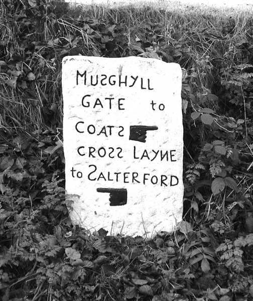
The marker stone on Cross Lane.