

I've been doing a bit of thinking about our physical environment, Don't worry, I am not going off on an eco-trip! This is about Barlick, how it sits on the land and how our perceptions of it can be skewed at times. Once we build and lay roads down we alter the look of the land. When we started using motorised transport we didn't have to worry about bumps and hollows and the consequence is we get divorced from the topography, the lie of the land, and how we have used it over the years.
For instance, stand on the side of the New Road outside the bus shelter at Salterforth and look towards Barlick. It's plain to see that the town is on top of the hill. Or is it? Look to your left and you'll see the embankment up to the canal. There is nothing more accurate than still water for indicating levels. There are no locks on the canal between Salterforth and Barlick so it's dead level. Now think about the fact that at Coates Bridge, above Barlick, the canal is well above the general level of the town. In other words, most of Barlick is at a lower level than you are stood on the roadside at Salterforth! True, your eyes tell you that the road is uphill towards the town but because it is so built up we forget that once over the rise at the school it falls quite steeply right down into the town.
Think about the town centre itself. Once you get your eye in and your brain in gear you can start to recognise that a series of valleys run down through Barlick from the South and the West. If you start walking up Park Road from Rainhall road it is only a gentle slope but turn right on Park Avenue and you are going up quite a steep hill. If you go forward across Manchester Road (Barnoldswick Lane in earlier years) and along Longfield Lane you drop steeply into Ouzledale Clough and then climb steeply up again on the other side before dropping down again towards Bancroft where you hit another valley running down from Tubber Hill, which again is climbing steeply even though it's heading towards Salterforth. You can recognise ups and downs like this all over the town.
So what? Why bother to think about these things? Because they have had an enormous influence on how the town grew from a series of hamlets dominated by what I think was the most important, Townhead (Guess how it got that name!), into the place we live in today. These slopes and valleys dictated the course of streams and in turn these produced the water sites which were so important in the early years of industrialisation. In later years these same streams were essential to steam power and set the sites of our first mills. To understand how we grew, we have to understand the lie of the land.
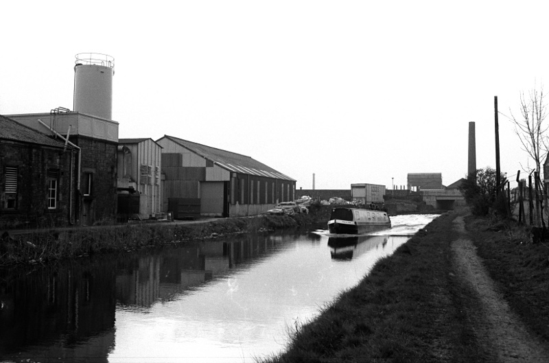
The canal at Long Ing in 1979. Above the level of the town!


