Last week we looked at our humps and hollows and how they influenced the development of Barlick. This week I want to look at our roads, let's start by going back a long way, about 3,000 years ago. You might think this is stretching things a bit but believe me, we are still using these routes today in the town.
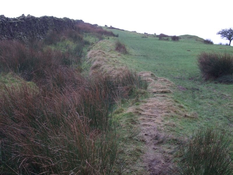
One of the first clues I came across was the name of a field behind Bancroft which slopes up towards what we now call Folly Lane. Forget about Moorgate Road, this is a new name that only came into being as the land was developed for housing. I got hold of a copy of the 1892 OS map and saw that it was called Causeway Carr. Causeway is an old name for a track, some old Barlickers still refer to the pavement as a causeway. Interesting and if you looked carefully you could see the outline of a raised track going up the hill. I had no explanation and stored the information away in my head. The next clue, though I didn't recognise it as such was that Park Avenue was originally called Bluepot Lane. I hadn't the faintest idea why, but again, it was interesting.
Over the years I began to wonder why Longfield Lane became Forty Steps and headed straight across to Bancroft. I discounted the fact often quoted that it was for workers to get to the mill because it was there long before Bancroft was built. It seemed to have no purpose. Then the penny dropped. I realised that the track down off Weets that became the causeway in the field was directly in line with Forty Steps, Longfield Lane and Bluepot Lane. Heading straight as an arrow out to the East. I did some serious digging, talked to the County Archaeologist who directed me towards some reading and found that what I was looking at was part of a much longer Bronze Age route from the Fylde coast to the East coast. Evidently there was a lively trade in Irish gold which was on its way to the Northern European states round the Baltic. Our track down from the Weets was, in effect, the Bronze Age M62. Its course from Barlick was towards Kildwick which was important because it was the most northerly low level crossing of the Pennines, that's why the monks later built a bridge there over the river.
We are certain that the area we now call Barlick had inhabitants and is it too much to expect that they could have provided a welcome overnight stop for heavily laden men and pack animals as they came down off the moor into sheltered ground? I like the idea and until someone proves otherwise I will contend that this could have been a factor in the establishment of our town.
I told you I would take you back 3,000 years. Next week we'll come forward in time and look at how the routes through the town grew.
Causeway Carr behind Bancroft Shed.