

Anyone who reads my columns regularly will know that I have been banging on about water and floods in Barlick for many years. They all know the story of the flood of July 1932 when a cloudburst on Whitemoor unleashed a wall of water on the town which overwhelmed the watercourses and caused a lot of damage. I'm writing this on the day after Boxing Day when we came very close to having a repetition of 1932.
Actually, that isn't quite right, the 1932 flood was the result of a short but very severe weather event, a summer storm that dropped an enormous amount of water on the moor over a very short period of time. We know from trustworthy contemporary accounts that two inch diameter hailstones floated down on the flood waters. It must have been a very bad thunderstorm, what we commonly call a 'cloudburst'. The ground was dry and baked hard and the water ran off the moor like a slate roof.
Yesterday was significantly different. I'm sure you will have noted that we have had the warmest and wettest November and December since records began. The ground was already sodden and could take no more water. Then we had over twenty four hours of continuous rain and the run-off from the moor brought the water levels in the becks up to heights I haven't seen in over fifty years. All the reports aren't in yet but it looks as though we were lucky, the culverts and their trash screens coped with the flow and there was no heavy flooding apart from some roads and of course the perennial problem of water trying to get from the RR sports ground into Ghyll Meadows. (I hope their temporary dam held.....)
There is still much controversy about what the effect of climate change is. However it's no accident that our floods coincided with some of the worst tornadoes on record in the Southern and Mid West United States. Meteorologists agree that a significant factor was the severe El Nino event in the Eastern Pacific ocean. It is almost certain that this is also the cause of the diversion of the Atlantic Jet Stream, the high level winds that bring in our weather, shifting North towards Iceland. This brought in the succession of winter storms which were the genesis of our unseasonably warm and wet weather. So, at least part of the cause of our floods yesterday is an event in the Pacific Ocean.
There is a lesson here for us. Extreme weather events will become more common and unpredictable. We must plan for worst case and expect more days like yesterday. We need to look to our own drains and exert pressure on the powers that be to maintain the culverts and trash screens on our watercourses. Long term we should remove the choke points in the drainage system. At the moment we are relying on 19th century infrastructure, much of which has had no significant upgrading.
One thing is certain we can't say we haven't been warned!
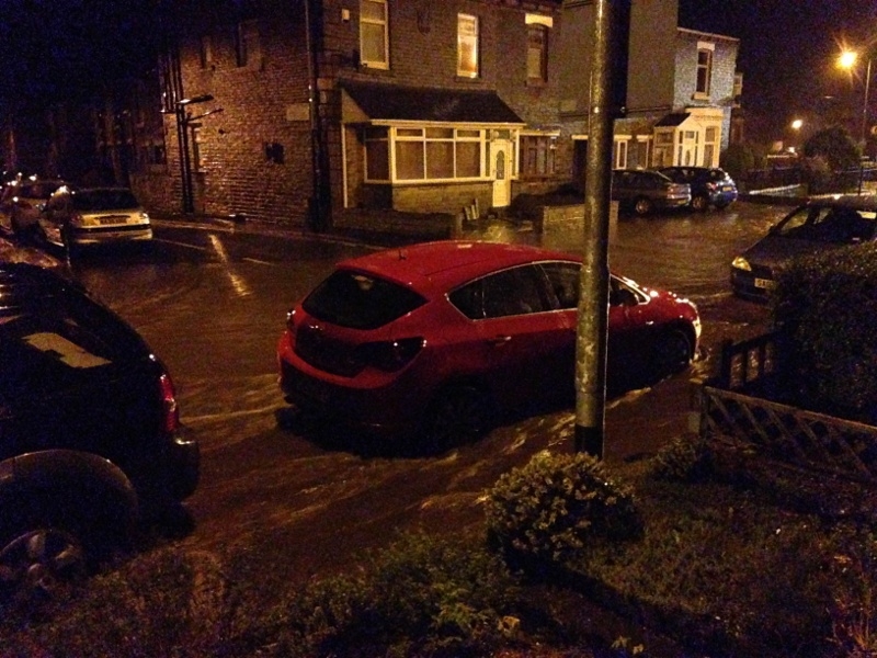
Just imagine this pouring into your house! Water Street in Earby on Boxing Day.(Susan Graham pic)